Clickable
map of River Segments on Wildcat Creek (South Fork)
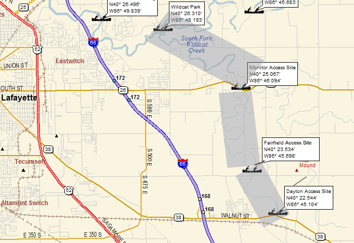
The South Fork should be floated in the spring or in
high flow. During the late summer dry periods it may
become too low to float. In low water (and for most
of the summer) the Monitor Access Site to First Wildcat
County Park segment of the creek, or on downstream on
the North Fork to the Wabash River and Davis Ferry County
Park, provides a better trip than one beginning at Dayton
(State Road 38).
Much of the South Fork flows through relatively level
farmland, although glacial kames (mounds) may be seen
in the creek valley, and there are some high banks along
the creek. There is little development along the South
Fork of Wildcat Creek, and a fringe of woodland along
the creek helps maintain its natural character.
Note: While the Wildcat Park access point is technically
on the North Fork, it is located right at the confluence
of the North and South Forks. So, Wildcat Park still
makes for a great take-out point for paddling trips
on the South Fork of Wildcat Creek.