 Welcome
to The Wildcat Creek Stream
Guide! Welcome
to The Wildcat Creek Stream
Guide!
We have put together an Easy
to Use and complete Guide to help you enjoy
this wonderful and scenic river. We start describing
the river near Greentown (east of Kokomo) and end
on the Wabash River in Lafayette.
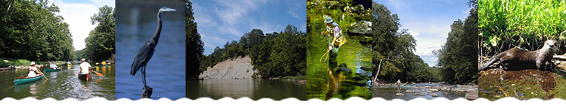
Wildcat Creek is very scenic and is teaming with
wildlife. There is one outfitter offering trips on a section of the river, but this website will also help visitors plan trips on their own.
HOW TO USE THIS WEBSITE
We have identified the information that you will
probably need to plan your next trip to Wildcat
Creek. It is important to know about:
- Access Points
- We have printable maps to the access points
as well as detailed pictures of the parking, path
to the river, and river access for every
access point to the river.
- River Segments
- We have created printable maps of the river
segments that you will be traveling on. We show
you mileages, bridges and power lines that you
will be going under.
- Current
Stream Flow - Click here to find out how Wildcat
Creek is running right now!
We have included some interpretations of what
the flow level actually means in terms of the
feel of the river.
- Local Weather - See what the weather will be for the day(s) of your intended trip on Wildcat Creek.
- Area Lodging - Find the perfect place to stay in the area so you can enjoy a day or two on the water, and take in some other area attractions.
- Additional information
- There are many businesses and organizations
that can help you enjoy Wildcat Creek.
RECREATION ON WILDCAT CREEK
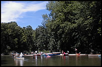
The North Fork and South Fork of Wildcat
Creek offer the best canoeing opportunities.
This website shows you where to access the creek
yourself for some paddling fun. Four to five days
of canoe trips are described on this website. However,
if you want to rent a canoe or kayak, check out
the great canoe livery operating on the river, Wildcat
Canoe and Kayak Too.
Wildcat Creek is also
an excellent place to enjoy quality fishing
and birdwatching. The river corridor is alive
with a variety of wildlife.
This website gives you the important details on
all the access points to the river so you can enjoy
it.
TOPOGRAPHY OF WILDCAT CREEK
Wildcat Creek consists
of three main forks-North, South, and Middle. All
forks flow in a general east-west direction through
varied topography and land uses, including cropland,
pasture, forest and developed areas.
Much of the bedrock in the Wildcat valley has been
eroded by pre-glacial drainage, and the valley has
been covered by glacial drift as a result of glaciation.
Several large glacial kames (mounds) are visible
from the South Fork of Wildcat
Creek. The North Fork of Wildcat cuts through
bedrock in a few areas, creating scenic overlooks
up to 130 feet above the stream.
|